
Full Breakdown
Dense Fog and Wind Warnings Follow UK Storms Austen and Boelo
By Drooid · · How we work
In this breakdown
01
Core Event
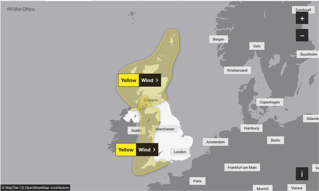
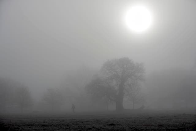
The United Kingdom’s national weather service has issued a dense-fog warning for central and southern England on Thursday morning and a yellow wind warning for 26 – 27 October. The alerts follow Storm Austen and Storm Boelo, which produced gusts of up to 80 mph, heavy rain and three fatalities. The Met Office cautions that the fog could be “locally dense” and persist into Friday, while the wind warning warns of “strong south-to-south-westerly winds” that may disrupt travel and power supplies.
02
Background & Context
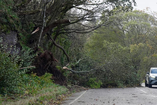
Storm Austen struck the southern UK on Friday, delivering gusts of 69 kn (?79 mph) on the Isle of Wight and rain up to 77.6 mm in Berwickshire. Storm Boelo followed on the weekend, with gusts in the low 80 mph range across Scotland, Northern Ireland and northern England, and 134.4 mm of rain in Ross and Cromarty. The combined impact left three people dead – two men struck by falling trees (a man in his 20s in Finchley and Richard Baines, 60, in Dumfries and Galloway) and a woman in her 50s pulled from the sea off the Isle of Wight – and caused power outages for roughly 90 000 properties.
Visual evidence
Images from the story



03
Data & Statistics
- Wind gusts: up to 80 mph.
- Rainfall: 77.6 mm (Austen, Berwickshire) and 134.4 mm (Boelo, Ross and Cromarty).
- Power outages: about 90 000 homes without electricity after the storms; 838 700 properties later reported without power across the UK.
- Fatalities: three deaths linked to falling trees and coastal hazards.
04
Official Statements & Responses
Forecaster Craig Snell said, “We’re saying goodbye to the low pressure and saying hello again to high pressure,” adding that the high-pressure ridge will bring “dense and stubborn fog” on Thursday, which may be “slow to clear.”
Meteorologist Alex Deakin noted that high pressure will dominate the east of the UK later in the week, while uncertainty remains about a front that could bring rain to western Scotland or northern Ireland on Friday.
05
Verbatim Quotes
- “One thing we do need to be aware of is the risk of some mist and fog and general murkiness, especially across central, southern parts of England. That’s where it’s likely to be most widespread, and locally dense first thing on Thursday morning. It could cause some problems on the road.” — Alex Burkill
- “We’re saying goodbye to the low pressure and saying hello again to high pressure.” — Mr Snell
- “Do not use full beam lights, as the fog reflects the light back, reducing visibility further.” — Met Office
06
On-the-Ground Reports
The Met Office’s social-media post on 28 October urged drivers to avoid full-beam lights and to keep windows slightly open at junctions to hear traffic. Coastal residents were reminded to stay alert to large waves and to keep dogs on leads. Households were advised to prepare for possible power cuts by gathering torches, spare batteries and a mobile-phone power bank.
07
What’s Next
High pressure is forecast to dominate from Wednesday, 28 October, bringing drier conditions and “settled” weather for much of the UK. The service expects “overnight and morning fog” to linger in southern and eastern areas through Thursday and Friday, with “misty and murky” conditions possible on Halloween night, 31 October. Travelers should monitor Met Office updates for any changes to the fog forecast.